Pile Family
Catchlove Family
Scott Family
Westbourne Family
References
Kelly's Directory 1911
Listed Buildings
The River Ems
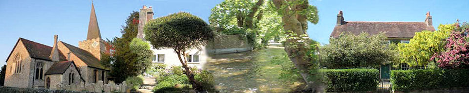
WESTBOURNE
A village history in West Sussex
YESTERYEAR
Home | Personal | Church | Scouts | Schools | Ambrose | Sketchbook | Workhouse | Census | Memories | Yesteryear | Publications | Village Website
THE RIVER WESTBOURNE
Although this river is not part of Westbourne village history, its name formation is the same.
The River Westbourne is a small River Thames tributary in west London, primarily sourced from Whitestone Pond, Hampstead Heath which, notwithstanding meanders, flows approximately southward to skirt east of Hyde Park's Serpentine lake after about 3.3 miles (5.3 km), to Sloane Square, Chelsea after about 1 mile (1.6 km), passes centrally under the south side of Royal Hospital Chelsea's Ranelagh Gardens after about 0.5 miles (0.8 km), then issues into the Inner London Tideway. Now, in common with several urbanised streams, its basin contributes to a network of storm drainage channels, with a sewer beneath its route.
The river was originally called the Kilburn (Cye Bourne – royal stream, 'Bourne' being an Anglo-
Rising in Hampstead the river flows south through Kilburn (also the name of the river at that point) running west along Kilburn Park Road and then south along Shirland Road. After crossing Bishops Bridge Road, the river continued more or less due south, between what is now Craven Terrace and what is now Gloucester Terrace. At this point, the river was known until the early nineteenth century as the Bayswater rivulet and from that it gave its name to the area now known as Bayswater. Originally Bayswater was the stretch of the stream where it crosses Bayswater Road, "Bayards Watering" in 1652 and "Bayards Watering Place" in 1654. It is said that there is a reference to Bayards Watering Place as early as 1380. There were a few houses at this spot in the eighteenth century and, it seems, a man called Bayard used or offered it as a watering place for horses on this road (formerly Uxbridge Road). The river enters Hyde Park at what is now the Serpentine and is within the park joined by a tributary, Tyburn Brook. The Serpentine was formed in 1730 by building a dam across the Westbourne at the instigation of Queen Caroline, wife of George II, to beautify the royal park. The Westbourne ceased to provide the water for the Serpentine in 1834, as the culverted Westbourne had become the most convenient main sewer and the Serpentine is now supplied from three boreholes from the upper chalk underneath Hyde Park and was widely imitated in parks and gardens nationwide.
The Westbourne left Hyde Park (both before and after it had been dammed to form the Serpentine) at Knightsbridge which was originally a bridge over the Westbourne itself. It is recorded that, in the year 1141, the citizens of London met Matilda of England (Queen Maud) at this bridge. The river ran from Knightsbridge south under Bourne Street, SW1 and follows very closely the boundary between the City of Westminster and the Royal Borough of Kensington and Chelsea, joining the River Thames at Chelsea.
The waters of the Westbourne or Bayswater were originally pure and in 1437 and 1439 conduits were laid to carry water from the Westbourne into the City of London, for drinking. In the nineteenth century, however, the water became filthy and impure by its use as a sewer, and the rise of the water closet as the prevailing form of sanitation.
When Belgravia, Chelsea and Paddington were developed, it became necessary to drive the river Westbourne underground to build over it. The river was therefore directed into pipes in the early part of the nineteenth century, work which was completed in the 1850s. Since then, the Westbourne has been one of the lost rivers of London, running underground in a pipe.
The pipe can still be seen running above the platform of Sloane Square tube station. It is located just below the ceiling towards the end of the platforms closest to the exits. The pipe is the original one constructed in the nineteenth century. Although the station was badly bombed during the Battle of Britain in November 1940, the old iron pipe was not damaged.
A vestige of the river, a wide quay opens into the river Thames about 300 yards (270 m) west of Chelsea Bridge. An overflow outfall, from a pipe named the Ranelagh Sewer, can still be seen at low tide, as most of the Westbourne's course has been used as a convenient depression in the land to place the local sewerage system, some of which takes surface water to form a combined sewer which links to two intercept sewers, the Middle Level Sewer and the Northern Low Level Sewer in the London sewerage system.
Source: http://en.wikipedia.org
